

Sasa unafuata
Hitilafu katika kufuata mtumiaji.
Mtumiaji huyu haruhusu watumiaji kumfuata.
Tayari unamfuata mtumiaji huyu.
Mpango wako wa uanachama unaruhusu tu ufautiliaji 0. Boresha hapa.
Umefaulu kuacha kufuata
Hitilafu wakati wa kuacha kumfuata mtumiaji.
Umefaulu kupendekeza
Hitilafu katika kumpendekeza mtumiaji
Hitilafu fulani imetokea. Tafadhali onyesha upya ukurasa na ujaribu tena.
Barua pepe imethibitishwa kwa ufanisi.

lahore,
pakistan
Ni saa 12:01 AM hapa
Alijiunga Julai 13, 2017
0 Mapendekezo
Muneeb A.
@MUNEEBAAMIR
0.0
0.0
0%
0%
lahore,
pakistan
N/A
Kazi Zilizokamilika
N/A
Kwa Bajeti
N/A
Kwa wakati
N/A
Kiwango cha Kuajiriwa Tena
Geospatial Expert
Wasiliana na Muneeb A. kuhusu kazi yako
Ingia ili kujadili maelezo yoyote kwenye gumzo.
Portfolio
Portfolio


Preparation of Digital Elevation Model
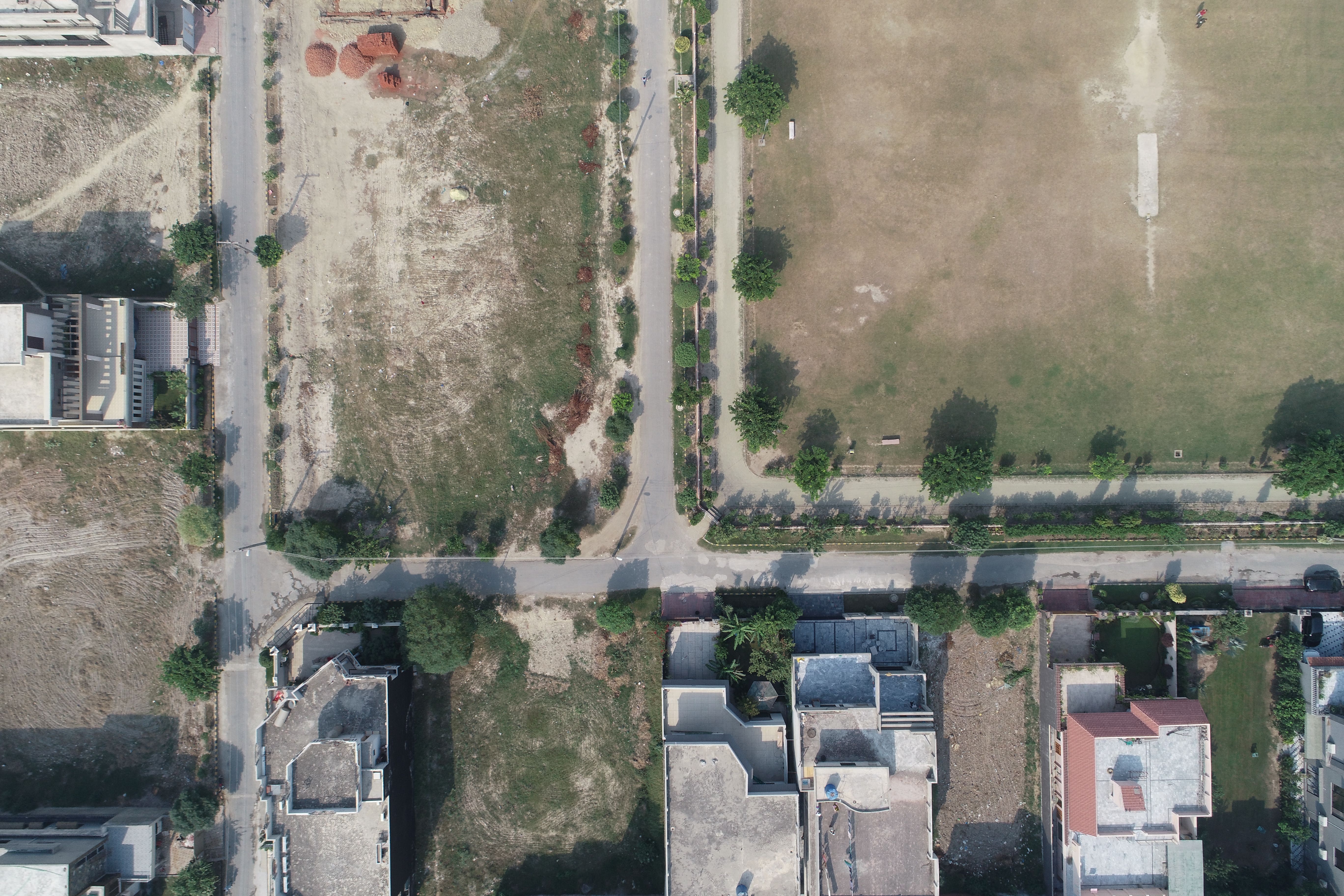

Drone Mapping

Drone Mapping

Drone Mapping
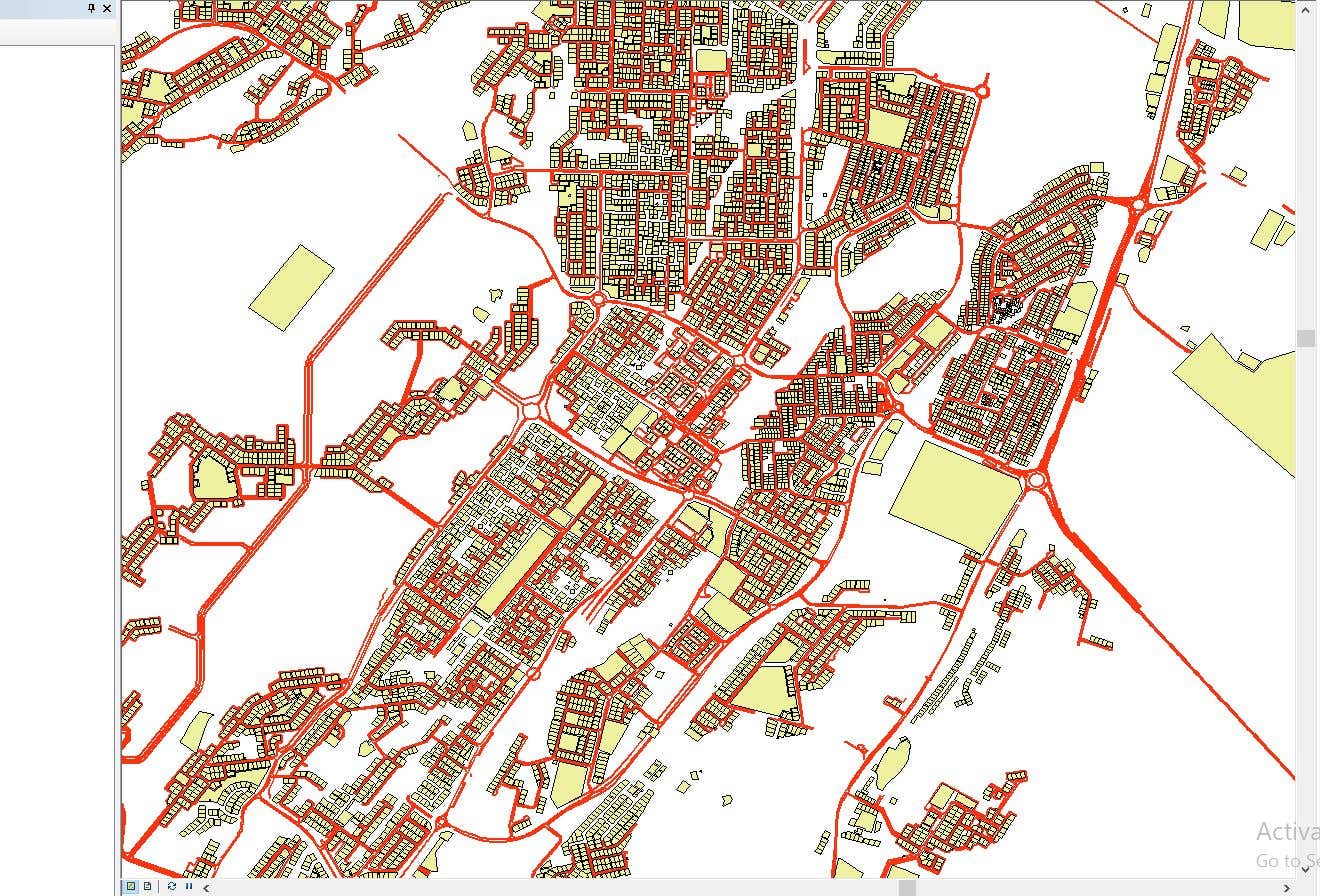

CAD to SHP Files

CAD to SHP Files
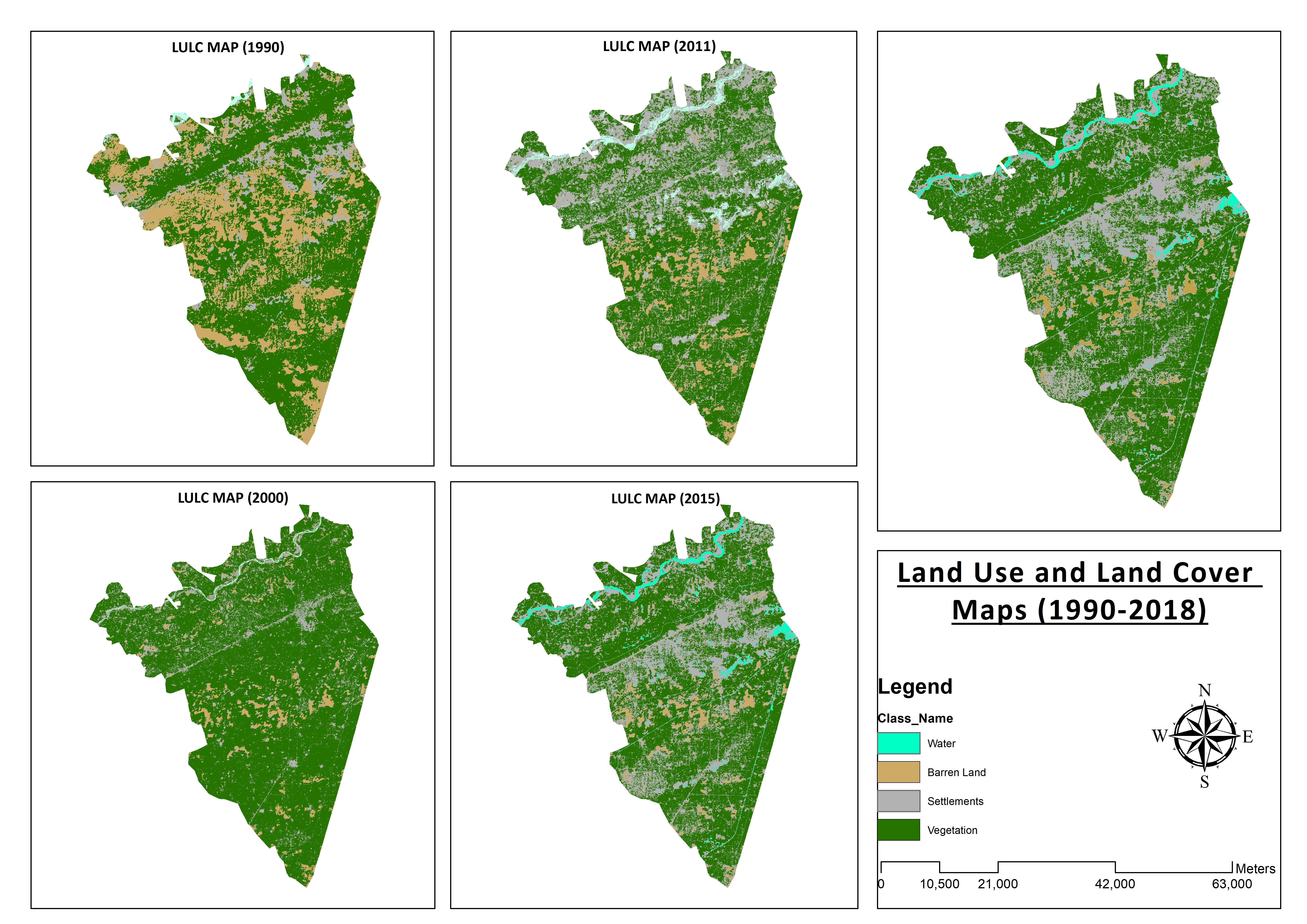

Land Use and Land Cover Maps
Preparation of Digital Elevation Model
Drone Mapping
Drone Mapping
Drone Mapping
CAD to SHP Files
CAD to SHP Files
Land Use and Land Cover Maps
Kaguzi
Mabadiliko yamehifadhiwa
Hakuna maoni ya kuona hapa!
Uzoefu
Remote Sensing and GIS Analyst
Sep 2018 - Okt 2019 (1 year, 1 month)
Developed, integrated and Implemented GIS and Geodesy based Topographic Survey Plans under different Hydro-Power Projects in Northern Pakistan, Extension of Canal Projects to increase its capacity in Sindh-Balochistan, Analysis of Suitable Site Selection for different development sites by using Drone for Aerial Mapping and their detailed pre-feasibility studies with different softwares, to analyse and interpret spatial data to produce interacting Maps and Reports while ensuring quality control.
Research Associate GIS
Okt 2015 - Okt 2018 (3 years)
Deployed GIS-based system under Urban Immovable Property Tax (UIPT) for Punjab Excise & Taxation Department. Provided comprehensive support in creating the system while take advantage of software suites like ArcGIS Suite and ERDAS Imagine. Prepared communicating maps to help surveyors in Analyzing geo-spatial data to verify it during ground truthing. Created shapefiles to merge topographical data with external data through layering process.
Elimu
Master of Philosophy in Geographic Information System
(2 years)
Bachelors in Geographic Information System
(4 years)
Sifa
MS-Office
TEVTA
2017
MS-Office Certification in MS-Word, Excel and Power Point.
Chapisho
Analysis of Flood Damage Assessment through Different Satellite Datasets in Southern Punjab,Pakistan
International Journal of Innovations in Science & Technology
RS and GIS techniques can achieve the objectives and significant analyses through visual interpretations. These techniques are also used to identify the flood affected regions. The study site was examined by applying supervised classification determining that 16900.96 Hectors of agriculture land was damaged while Sparse Riverine Forest had the area 44.52 hectors. The damaged built-up area was 1805.78 Hectors.
Estimation of Net Rice Production by Remote Sensing and Multi Source Datasets
Sarhad Journal Of Agriculture
Estimation of net crop production before harvest enables agronomists and decision makers to determine the volume of grain precisely. Yield estimation is one of the challenging tasks which is significant to evaluate accurately for farmers. This research was conducted in eastern Punjab Pakistan by incorporating yield/area as reported by Crop Reporting Service Department along with open source satellite datasets.
Wasiliana na Muneeb A. kuhusu kazi yako
Ingia ili kujadili maelezo yoyote kwenye gumzo.
Udhibitisho
Ujuzi wa Juu
Angalia Wafanyakazi Huru sawia:
Pitia Onyesho Sawia
Mwaliko umetumwa kwa mafanikio
Asante! Tumekutumia kiungo cha kudai mkopo wako bila malipo kwa barua pepe.
Hitilafu fulani imetokea wakati wa kutuma barua pepe yako. Tafadhali jaribu tena.
Imeshindwa kunakili kwenye ubao wa kunakili, tafadhali jaribu tena baada ya kurekebisha ruhusa zako.
Imenakiliwa kwenye ubao wa kunakili.
Onyesho la kukagua linapakia
Ruhusa imetolewa kwa Uwekaji wa Kijiografia.
Muda wako wa kuingia umeisha na umetoka nje. Tafadhali ingia tena.